This blog is a combination of John's writing and a little of Christi's. We both kept notes during our time on the trail and, turns out, both of us had largely the same perception of events so we've tried to keep the writing brief and only included both of our journal entries if it seemed to add something to the narrative.
The photos on each of the posts can all be enlarged by clicking on them.
Intro - How'd we get here?
By “here” I don’t mean sitting comfortably in Olympia this September morn’ while I compose this narrative nor do I mean how is it that life began. I mean just what is it that compelled us to decide we wanted to through-hike the John Muir Trail (JMT)?
As with most significant events in life (mine, at least), it was a chance happening. Last summer we were descending Rampart Ridge below Mt. Rainier – probably running from mosquitoes, particularly pesky at the time – and stopped to help a woman coming up the trail figure out how to use her new GPS. We got to talking as trail folk are wont to do and she mentioned she planned to complete section-hiking the Pacific Crest Trail (PCT) - a 2,663 mile trail that stretches from the borders of Mexico to Canada - by her approaching 70th birthday. She’d been gradually completing the PCT in 200 – 500 mile sections and wanted to get them all done before she entered her next decade.
This conversation prompted me to ask myself “What have I accomplished in my life?” Sixty-one at the time, I wondered why not do something challenging before I enter my next decade. Christi and I both liked to hike, having completed the relatively luxurious 42 mile Queen Charlotte Track in New Zealand the previous year, so we began learning more about the PCT.
In the process, we “discovered” the JMT, which covers some of the same terrain through the high Sierra Nevada in California. We were intrigued. As Peter Potterfield wrote in his Classic Hikes of the World, the JMT “travels through what many consider the most inspiring terrain available to backpackers in North America.” Some 222 miles long from trailhead-to-trailhead, it includes the longest section of wilderness trail unbroken by a road in the contiguous US and some of the world’s most spectacular high-mountain scenery, and ascends 14,505 foot Mt. Whitney, the highest mountain in the lower 48.
Sure it includes 9 major passes over 10,000 feet and a cumulative elevation gain of over 45,000 feet but it seemed we’d be able to do it over a several week period.The 2,663 mile PCT would require a time commitment of 5 – 6 months. Through-hiking the JMT seemed quite reasonable in comparison.
Planning, planning and more planning
So, about a year ago, we decided we’d do it, targeting August or September 2011. At that time we thought we’d see how the winter weather played out to avoid a lot of snow on the high passes before deciding upon a start date. We now know about all the snow the Cascades had late last winter and the following spring. Well, the Sierra’s had it too, but we didn’t see that coming when we began checking into wilderness permit reservations in February.
Some JMT wilderness permits are available on a walk-up basis but most are booked up to 6 months in advance. When we began checking on August dates last February we panicked, as people were gobbling up the permits well in advance. Having never done the trail before, we felt we needed to book something so we began madly faxing requests. Most were denied, but we did end up with 3 separate reservations for 3 separate dates in early August. Unfortunately, each involved either starting from an out-of-the-way Yosemite Valley trailhead or staying the first night at a campsite several miles off the JMT.
As we watched the snow fall throughout the spring, we began planning and planning and planning. Not only did we have to acquire equipment, most of which had changed (for the better) since I last backpacked with my kids in the 80’s, but we had to figure out logistics – where to start, where to leave a car, etc. – what food to take, how many drops to have and where to have them, and, oh yeah, get in condition! We eventually decided we’d use our August 6 reservation to start the trail at Happy Isles trailhead in Yosemite, spending our first night off trail at Illilouette Valley, if necessary.
Fortunately, there are some great resources available to help plan the hike. Among them is the John Muir Trail Yahoo Group whose members include very friendly and helpful folks who know the trail well, equipment and menu guides, maps and plans, including GPS data points, and a ton of other helpful planning information, and Elizabeth Wenk’s guidebook John Muir Trail. And, not to go too commercial on you, but if you aren’t ready to buy a bear canister (which you’ll need for food on the JMT), you can rent one of the lightest-weight available “Bearikades” from Wild Ideas at a very reasonable fee for through-hikers.
Planning, shmaning, let’s hit the trail!
Needless to say, we both tired of the months of analysis and planning, figuring how-to-maximize-calories while minimizing weight carried, packing and repacking. We wanted to hit the trail and start doing it (hiking, that is)! Our Bearikade Weekenders arrived a few days early in late July, we packed our bucket to ship to the Muir Trail Ranch, our last food drop for the last half of the trail, and were fortunate enough to leave Olympia, WA, to spend a preliminary week at our condo in Bend, OR, before driving down east of the Cascades and Sierras, mostly staying above 4,000 feet elevation to begin acclimatizing.
On the way down we stayed at Lake Tahoe a couple nights and began to see teasing scenes of that awesome water-flowing-over-granite scenery as we drove south from there. More scenery as we delivered our food drops to Tuolomne Meadows and Red Meadows – massive granite formations, deep valleys and huge, steep mountains!
The day before we caught the bus over to Yosemite Valley, we rented a car in Mammoth Lakes and then drove our car down to the Whitney Portal, west of Lone Pine, picking up a couple of hitchhikers, Adrianne and Darren, from Ashland, OR, who were commencing a 28-day High Sierra Trail adventure. We were stunned by the beautiful scenery with Mt. Whitney looming behind when we drove up to Whitney Portal.
Last minute anxiety
We took the shuttle from Mammoth Lakes to Reds Meadow store to leave our second food drop and, on the return, overheard a group of backpackers who had exited at Reds Meadow talking about how difficult Donohue Pass was – too much snow, one of them got altitude sickness, and they exited early. We worried some about altitude when Christi got a severe headache and nausea for a day or so (in retrospect, probably due to coffee withdrawal) and then worried some more waiting for the bus over to Yosemite from Mammoth Lakes when we met some other hikers returning to Tuolomne Meadows to retrieve their car following a very difficult hike (snow and altitude) from TM to Reds Meadow.
But these worries quickly evaporated when we began the bus ride over to Yosemite. We were like a couple of awestruck kids going to school for the first day, all excited about the adventure that awaited us and continually blown away by the views, deep blue skies and crystal clear weather.
As with most significant events in life (mine, at least), it was a chance happening. Last summer we were descending Rampart Ridge below Mt. Rainier – probably running from mosquitoes, particularly pesky at the time – and stopped to help a woman coming up the trail figure out how to use her new GPS. We got to talking as trail folk are wont to do and she mentioned she planned to complete section-hiking the Pacific Crest Trail (PCT) - a 2,663 mile trail that stretches from the borders of Mexico to Canada - by her approaching 70th birthday. She’d been gradually completing the PCT in 200 – 500 mile sections and wanted to get them all done before she entered her next decade.
This conversation prompted me to ask myself “What have I accomplished in my life?” Sixty-one at the time, I wondered why not do something challenging before I enter my next decade. Christi and I both liked to hike, having completed the relatively luxurious 42 mile Queen Charlotte Track in New Zealand the previous year, so we began learning more about the PCT.
 |
| John Muir |
Sure it includes 9 major passes over 10,000 feet and a cumulative elevation gain of over 45,000 feet but it seemed we’d be able to do it over a several week period.The 2,663 mile PCT would require a time commitment of 5 – 6 months. Through-hiking the JMT seemed quite reasonable in comparison.
Planning, planning and more planning
So, about a year ago, we decided we’d do it, targeting August or September 2011. At that time we thought we’d see how the winter weather played out to avoid a lot of snow on the high passes before deciding upon a start date. We now know about all the snow the Cascades had late last winter and the following spring. Well, the Sierra’s had it too, but we didn’t see that coming when we began checking into wilderness permit reservations in February.
Some JMT wilderness permits are available on a walk-up basis but most are booked up to 6 months in advance. When we began checking on August dates last February we panicked, as people were gobbling up the permits well in advance. Having never done the trail before, we felt we needed to book something so we began madly faxing requests. Most were denied, but we did end up with 3 separate reservations for 3 separate dates in early August. Unfortunately, each involved either starting from an out-of-the-way Yosemite Valley trailhead or staying the first night at a campsite several miles off the JMT.
As we watched the snow fall throughout the spring, we began planning and planning and planning. Not only did we have to acquire equipment, most of which had changed (for the better) since I last backpacked with my kids in the 80’s, but we had to figure out logistics – where to start, where to leave a car, etc. – what food to take, how many drops to have and where to have them, and, oh yeah, get in condition! We eventually decided we’d use our August 6 reservation to start the trail at Happy Isles trailhead in Yosemite, spending our first night off trail at Illilouette Valley, if necessary.
Fortunately, there are some great resources available to help plan the hike. Among them is the John Muir Trail Yahoo Group whose members include very friendly and helpful folks who know the trail well, equipment and menu guides, maps and plans, including GPS data points, and a ton of other helpful planning information, and Elizabeth Wenk’s guidebook John Muir Trail. And, not to go too commercial on you, but if you aren’t ready to buy a bear canister (which you’ll need for food on the JMT), you can rent one of the lightest-weight available “Bearikades” from Wild Ideas at a very reasonable fee for through-hikers.
Planning, shmaning, let’s hit the trail!
Needless to say, we both tired of the months of analysis and planning, figuring how-to-maximize-calories while minimizing weight carried, packing and repacking. We wanted to hit the trail and start doing it (hiking, that is)! Our Bearikade Weekenders arrived a few days early in late July, we packed our bucket to ship to the Muir Trail Ranch, our last food drop for the last half of the trail, and were fortunate enough to leave Olympia, WA, to spend a preliminary week at our condo in Bend, OR, before driving down east of the Cascades and Sierras, mostly staying above 4,000 feet elevation to begin acclimatizing.
On the way down we stayed at Lake Tahoe a couple nights and began to see teasing scenes of that awesome water-flowing-over-granite scenery as we drove south from there. More scenery as we delivered our food drops to Tuolomne Meadows and Red Meadows – massive granite formations, deep valleys and huge, steep mountains!
The day before we caught the bus over to Yosemite Valley, we rented a car in Mammoth Lakes and then drove our car down to the Whitney Portal, west of Lone Pine, picking up a couple of hitchhikers, Adrianne and Darren, from Ashland, OR, who were commencing a 28-day High Sierra Trail adventure. We were stunned by the beautiful scenery with Mt. Whitney looming behind when we drove up to Whitney Portal.
Last minute anxiety
We took the shuttle from Mammoth Lakes to Reds Meadow store to leave our second food drop and, on the return, overheard a group of backpackers who had exited at Reds Meadow talking about how difficult Donohue Pass was – too much snow, one of them got altitude sickness, and they exited early. We worried some about altitude when Christi got a severe headache and nausea for a day or so (in retrospect, probably due to coffee withdrawal) and then worried some more waiting for the bus over to Yosemite from Mammoth Lakes when we met some other hikers returning to Tuolomne Meadows to retrieve their car following a very difficult hike (snow and altitude) from TM to Reds Meadow.
But these worries quickly evaporated when we began the bus ride over to Yosemite. We were like a couple of awestruck kids going to school for the first day, all excited about the adventure that awaited us and continually blown away by the views, deep blue skies and crystal clear weather.
August 5-“Stop, the trail is closed”
 Miles Hiked: 4.9 Total: 4.9
Elevation Gain: 2928 ft
 |
| John and Christi at the start of the JMT 2011 |
OUR NATIONAL PARKS - pub. 1901
[John]
We maneuvered through the CROWDS, including bike riding tourists listening to loud urban rap music amidst the scenery, and made it to the Yosemite Valley wilderness permit office around 1 PM. All the rangers were really helpful and we ended up getting a permit to start from the Happy Isles trailhead that afternoon, rather than the next day. Unfortunately, we still had to spend the first night in the Illilouette, requiring us to go a few miles off trail, but, heck, we got to start a half-day earlier than planned! We grabbed a deli sandwich, a couple cookies and Gatorades, and hopped on the shuttle to take us to the trailhead.
 |
| Looking back at Yosemite Falls from the trail |
Coincidentally, the park service had just found the bodies of the three tourists who were swept over Vernal Falls on July 20th, closing the trail to the falls temporarily while they ferried them out by helicopter, so we had to endure the descending tourists yelling at us “Don’t go any further, the trail is closed!” as we ascended the JMT which, of course, was not closed. Did they really think we’d be doing a day hike to Vernal Falls with those heavy packs on our backs?
 |
| Liberty Cap and Nevada Falls |
We had dinner on the river above Nevada Falls before proceeding a little more than a mile back to the south, off the Panorama Trail, where we dry camped the first night on a ridge across from Liberty Cap. It was warm so we slept without the rain fly, and could see the zillions of stars rotate across the sky from dark to dawn. It was beautiful, the air was fresh and clean and we could hear Nevada Falls roaring in the distance. We awoke the next morning to the sun lighting up the south face of Liberty Cap. It seemed like the mid-afternoon start in the sweltering heat was worth it!
[Christi]
What a day! We finally made it and have started this long-awaited adventure. Whew! New to backbacking, I'm still getting used to the 25-30 pounds on my back but it's not so bad really. It was good to get up and away from the crowds of people below. The stars were amazing and the cool fresh, clean mountain air soothed our aching bodies as we drifted in and out of sleep.
August 6-Getting ready for the mosquitoes
 Miles Hiked: 11.05 Total: 15.99
Elevation Gain: 3817 ft
“You may be a little cold some nights, on mountain tops above the timber-line, but you will see the stars, and by and by you can sleep enough in your town bed, or at least in your grave.” ~John Muir
OUR NATIONAL PARKS - pub. 1901
[John]
We were both anxious to get as far as we could, short of Sunrise Meadow, which we had heard was infested with mosquitoes. We got an early morning start before the heat got too bad and were above 8,000 feet before the mid-afternoon heat set in.


As always the views were beautiful, but we didn’t appreciate that we were over 3,000 feet higher than the night before and the temperature drops more at night. We left the tent fly off again so we could see the stars and we got cold. I didn’t sleep well and was experiencing some of the “altitude apnea” that would periodically plague me. There was ice on the tent sack the next morning, but we quickly forgot it after we hit the trail and started sweating.
[Christi]
What a pleasure to awake at sunrise to the sound of deer tramping leisurely past our campsite! We both slept well...occasionally. Our bones are cold and the trail beckons. More climbing today. I think this will become a common refrain!
August 7-Hey, this IS hard work and that burger sure tastes good!
 Miles Hiked: 13.6 Total: 25.59
Elevation Gain: 1436 ft
 |
| Sunrise Meadow - Cathedral Peak and Pass in the distance |
OUR NATIONAL PARKS - pub 1901
[John]
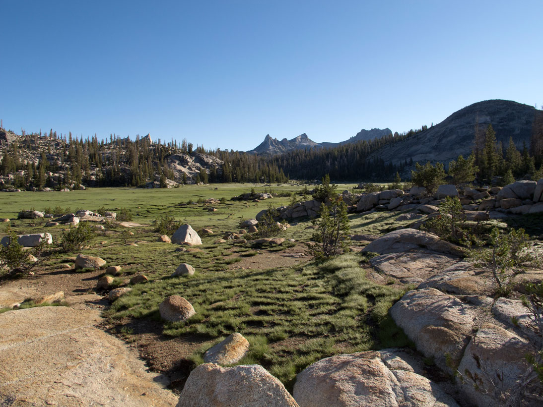
All prepared for mosquitoes, we descended into Sunrise Meadows early. We made it through before the mosquitoes were fully awake, enjoying the views of the approaching Cathedral Range. We went over Cathedral Pass and descended into Cathedral Lakes where the mosquitoes were beginning to congregate. We began seeing more and more day hikers venturing out from Tuolomne Meadows trailheads.
It was Sunday and we assumed we’d not be able to pick up our food drop at Tuolomne Meadows (TM) post office until after 9 AM the next morning, so we proceeded to the backpacker’s camp at TM after availing ourselves of the convenient restroom facilities near the information center.
After setting up camp at the backpacker’s camp and cleaning up a bit at the restroom sinks, we went down to the store and grill, where we had yummy burgers, lemonade and some potato chips. It was nice to eat something other than trail food!
 |
| Unicorn Peak |
We got to bed early as we were both really tired, having climbed over 7,000 feet and hiked over 27 miles during our initial 2 ½ days on the trail. Before turning in for the night, we met Zoe and her dad, David, Wayne and Isaiah, the foursome from Boston, who camped next to us and shared our bear box.
Although we were back down below 8,000 feet, we used our rain fly that night and were glad we did, as the following morning was cold!
Subscribe to:
Comments (Atom)