This blog is a combination of John's writing and a little of Christi's. We both kept notes during our time on the trail and, turns out, both of us had largely the same perception of events so we've tried to keep the writing brief and only included both of our journal entries if it seemed to add something to the narrative.
The photos on each of the posts can all be enlarged by clicking on them.
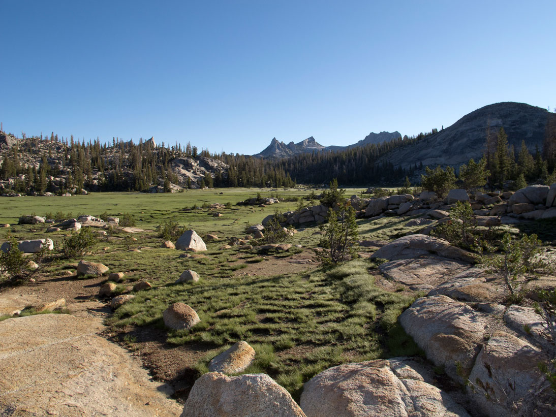
Intro - How'd we get here?
By “here” I don’t mean sitting comfortably in Olympia this September morn’ while I compose this narrative nor do I mean how is it that life began. I mean just what is it that compelled us to decide we wanted to through-hike the John Muir Trail (JMT)?
As with most significant events in life (mine, at least), it was a chance happening. Last summer we were descending Rampart Ridge below Mt. Rainier – probably running from mosquitoes, particularly pesky at the time – and stopped to help a woman coming up the trail figure out how to use her new GPS. We got to talking as trail folk are wont to do and she mentioned she planned to complete section-hiking the Pacific Crest Trail (PCT) - a 2,663 mile trail that stretches from the borders of Mexico to Canada - by her approaching 70th birthday. She’d been gradually completing the PCT in 200 – 500 mile sections and wanted to get them all done before she entered her next decade.
This conversation prompted me to ask myself “What have I accomplished in my life?” Sixty-one at the time, I wondered why not do something challenging before I enter my next decade. Christi and I both liked to hike, having completed the relatively luxurious 42 mile Queen Charlotte Track in New Zealand the previous year, so we began learning more about the PCT.
In the process, we “discovered” the JMT, which covers some of the same terrain through the high Sierra Nevada in California. We were intrigued. As Peter Potterfield wrote in his Classic Hikes of the World, the JMT “travels through what many consider the most inspiring terrain available to backpackers in North America.” Some 222 miles long from trailhead-to-trailhead, it includes the longest section of wilderness trail unbroken by a road in the contiguous US and some of the world’s most spectacular high-mountain scenery, and ascends 14,505 foot Mt. Whitney, the highest mountain in the lower 48.
Sure it includes 9 major passes over 10,000 feet and a cumulative elevation gain of over 45,000 feet but it seemed we’d be able to do it over a several week period.The 2,663 mile PCT would require a time commitment of 5 – 6 months. Through-hiking the JMT seemed quite reasonable in comparison.
Planning, planning and more planning
So, about a year ago, we decided we’d do it, targeting August or September 2011. At that time we thought we’d see how the winter weather played out to avoid a lot of snow on the high passes before deciding upon a start date. We now know about all the snow the Cascades had late last winter and the following spring. Well, the Sierra’s had it too, but we didn’t see that coming when we began checking into wilderness permit reservations in February.
Some JMT wilderness permits are available on a walk-up basis but most are booked up to 6 months in advance. When we began checking on August dates last February we panicked, as people were gobbling up the permits well in advance. Having never done the trail before, we felt we needed to book something so we began madly faxing requests. Most were denied, but we did end up with 3 separate reservations for 3 separate dates in early August. Unfortunately, each involved either starting from an out-of-the-way Yosemite Valley trailhead or staying the first night at a campsite several miles off the JMT.
As we watched the snow fall throughout the spring, we began planning and planning and planning. Not only did we have to acquire equipment, most of which had changed (for the better) since I last backpacked with my kids in the 80’s, but we had to figure out logistics – where to start, where to leave a car, etc. – what food to take, how many drops to have and where to have them, and, oh yeah, get in condition! We eventually decided we’d use our August 6 reservation to start the trail at Happy Isles trailhead in Yosemite, spending our first night off trail at Illilouette Valley, if necessary.
Fortunately, there are some great resources available to help plan the hike. Among them is the John Muir Trail Yahoo Group whose members include very friendly and helpful folks who know the trail well, equipment and menu guides, maps and plans, including GPS data points, and a ton of other helpful planning information, and Elizabeth Wenk’s guidebook John Muir Trail. And, not to go too commercial on you, but if you aren’t ready to buy a bear canister (which you’ll need for food on the JMT), you can rent one of the lightest-weight available “Bearikades” from Wild Ideas at a very reasonable fee for through-hikers.
Planning, shmaning, let’s hit the trail!
Needless to say, we both tired of the months of analysis and planning, figuring how-to-maximize-calories while minimizing weight carried, packing and repacking. We wanted to hit the trail and start doing it (hiking, that is)! Our Bearikade Weekenders arrived a few days early in late July, we packed our bucket to ship to the Muir Trail Ranch, our last food drop for the last half of the trail, and were fortunate enough to leave Olympia, WA, to spend a preliminary week at our condo in Bend, OR, before driving down east of the Cascades and Sierras, mostly staying above 4,000 feet elevation to begin acclimatizing.
On the way down we stayed at Lake Tahoe a couple nights and began to see teasing scenes of that awesome water-flowing-over-granite scenery as we drove south from there. More scenery as we delivered our food drops to Tuolomne Meadows and Red Meadows – massive granite formations, deep valleys and huge, steep mountains!
The day before we caught the bus over to Yosemite Valley, we rented a car in Mammoth Lakes and then drove our car down to the Whitney Portal, west of Lone Pine, picking up a couple of hitchhikers, Adrianne and Darren, from Ashland, OR, who were commencing a 28-day High Sierra Trail adventure. We were stunned by the beautiful scenery with Mt. Whitney looming behind when we drove up to Whitney Portal.
Last minute anxiety
We took the shuttle from Mammoth Lakes to Reds Meadow store to leave our second food drop and, on the return, overheard a group of backpackers who had exited at Reds Meadow talking about how difficult Donohue Pass was – too much snow, one of them got altitude sickness, and they exited early. We worried some about altitude when Christi got a severe headache and nausea for a day or so (in retrospect, probably due to coffee withdrawal) and then worried some more waiting for the bus over to Yosemite from Mammoth Lakes when we met some other hikers returning to Tuolomne Meadows to retrieve their car following a very difficult hike (snow and altitude) from TM to Reds Meadow.
But these worries quickly evaporated when we began the bus ride over to Yosemite. We were like a couple of awestruck kids going to school for the first day, all excited about the adventure that awaited us and continually blown away by the views, deep blue skies and crystal clear weather.
As with most significant events in life (mine, at least), it was a chance happening. Last summer we were descending Rampart Ridge below Mt. Rainier – probably running from mosquitoes, particularly pesky at the time – and stopped to help a woman coming up the trail figure out how to use her new GPS. We got to talking as trail folk are wont to do and she mentioned she planned to complete section-hiking the Pacific Crest Trail (PCT) - a 2,663 mile trail that stretches from the borders of Mexico to Canada - by her approaching 70th birthday. She’d been gradually completing the PCT in 200 – 500 mile sections and wanted to get them all done before she entered her next decade.
This conversation prompted me to ask myself “What have I accomplished in my life?” Sixty-one at the time, I wondered why not do something challenging before I enter my next decade. Christi and I both liked to hike, having completed the relatively luxurious 42 mile Queen Charlotte Track in New Zealand the previous year, so we began learning more about the PCT.
 |
| John Muir |
Sure it includes 9 major passes over 10,000 feet and a cumulative elevation gain of over 45,000 feet but it seemed we’d be able to do it over a several week period.The 2,663 mile PCT would require a time commitment of 5 – 6 months. Through-hiking the JMT seemed quite reasonable in comparison.
Planning, planning and more planning
So, about a year ago, we decided we’d do it, targeting August or September 2011. At that time we thought we’d see how the winter weather played out to avoid a lot of snow on the high passes before deciding upon a start date. We now know about all the snow the Cascades had late last winter and the following spring. Well, the Sierra’s had it too, but we didn’t see that coming when we began checking into wilderness permit reservations in February.
Some JMT wilderness permits are available on a walk-up basis but most are booked up to 6 months in advance. When we began checking on August dates last February we panicked, as people were gobbling up the permits well in advance. Having never done the trail before, we felt we needed to book something so we began madly faxing requests. Most were denied, but we did end up with 3 separate reservations for 3 separate dates in early August. Unfortunately, each involved either starting from an out-of-the-way Yosemite Valley trailhead or staying the first night at a campsite several miles off the JMT.
As we watched the snow fall throughout the spring, we began planning and planning and planning. Not only did we have to acquire equipment, most of which had changed (for the better) since I last backpacked with my kids in the 80’s, but we had to figure out logistics – where to start, where to leave a car, etc. – what food to take, how many drops to have and where to have them, and, oh yeah, get in condition! We eventually decided we’d use our August 6 reservation to start the trail at Happy Isles trailhead in Yosemite, spending our first night off trail at Illilouette Valley, if necessary.
Fortunately, there are some great resources available to help plan the hike. Among them is the John Muir Trail Yahoo Group whose members include very friendly and helpful folks who know the trail well, equipment and menu guides, maps and plans, including GPS data points, and a ton of other helpful planning information, and Elizabeth Wenk’s guidebook John Muir Trail. And, not to go too commercial on you, but if you aren’t ready to buy a bear canister (which you’ll need for food on the JMT), you can rent one of the lightest-weight available “Bearikades” from Wild Ideas at a very reasonable fee for through-hikers.
Planning, shmaning, let’s hit the trail!
Needless to say, we both tired of the months of analysis and planning, figuring how-to-maximize-calories while minimizing weight carried, packing and repacking. We wanted to hit the trail and start doing it (hiking, that is)! Our Bearikade Weekenders arrived a few days early in late July, we packed our bucket to ship to the Muir Trail Ranch, our last food drop for the last half of the trail, and were fortunate enough to leave Olympia, WA, to spend a preliminary week at our condo in Bend, OR, before driving down east of the Cascades and Sierras, mostly staying above 4,000 feet elevation to begin acclimatizing.
On the way down we stayed at Lake Tahoe a couple nights and began to see teasing scenes of that awesome water-flowing-over-granite scenery as we drove south from there. More scenery as we delivered our food drops to Tuolomne Meadows and Red Meadows – massive granite formations, deep valleys and huge, steep mountains!
The day before we caught the bus over to Yosemite Valley, we rented a car in Mammoth Lakes and then drove our car down to the Whitney Portal, west of Lone Pine, picking up a couple of hitchhikers, Adrianne and Darren, from Ashland, OR, who were commencing a 28-day High Sierra Trail adventure. We were stunned by the beautiful scenery with Mt. Whitney looming behind when we drove up to Whitney Portal.
Last minute anxiety
We took the shuttle from Mammoth Lakes to Reds Meadow store to leave our second food drop and, on the return, overheard a group of backpackers who had exited at Reds Meadow talking about how difficult Donohue Pass was – too much snow, one of them got altitude sickness, and they exited early. We worried some about altitude when Christi got a severe headache and nausea for a day or so (in retrospect, probably due to coffee withdrawal) and then worried some more waiting for the bus over to Yosemite from Mammoth Lakes when we met some other hikers returning to Tuolomne Meadows to retrieve their car following a very difficult hike (snow and altitude) from TM to Reds Meadow.
But these worries quickly evaporated when we began the bus ride over to Yosemite. We were like a couple of awestruck kids going to school for the first day, all excited about the adventure that awaited us and continually blown away by the views, deep blue skies and crystal clear weather.
August 5-“Stop, the trail is closed”
 Miles Hiked: 4.9 Total: 4.9
Elevation Gain: 2928 ft
 |
| John and Christi at the start of the JMT 2011 |
OUR NATIONAL PARKS - pub. 1901
[John]
We maneuvered through the CROWDS, including bike riding tourists listening to loud urban rap music amidst the scenery, and made it to the Yosemite Valley wilderness permit office around 1 PM. All the rangers were really helpful and we ended up getting a permit to start from the Happy Isles trailhead that afternoon, rather than the next day. Unfortunately, we still had to spend the first night in the Illilouette, requiring us to go a few miles off trail, but, heck, we got to start a half-day earlier than planned! We grabbed a deli sandwich, a couple cookies and Gatorades, and hopped on the shuttle to take us to the trailhead.
 |
| Looking back at Yosemite Falls from the trail |
Coincidentally, the park service had just found the bodies of the three tourists who were swept over Vernal Falls on July 20th, closing the trail to the falls temporarily while they ferried them out by helicopter, so we had to endure the descending tourists yelling at us “Don’t go any further, the trail is closed!” as we ascended the JMT which, of course, was not closed. Did they really think we’d be doing a day hike to Vernal Falls with those heavy packs on our backs?
 |
| Liberty Cap and Nevada Falls |
We had dinner on the river above Nevada Falls before proceeding a little more than a mile back to the south, off the Panorama Trail, where we dry camped the first night on a ridge across from Liberty Cap. It was warm so we slept without the rain fly, and could see the zillions of stars rotate across the sky from dark to dawn. It was beautiful, the air was fresh and clean and we could hear Nevada Falls roaring in the distance. We awoke the next morning to the sun lighting up the south face of Liberty Cap. It seemed like the mid-afternoon start in the sweltering heat was worth it!
[Christi]
What a day! We finally made it and have started this long-awaited adventure. Whew! New to backbacking, I'm still getting used to the 25-30 pounds on my back but it's not so bad really. It was good to get up and away from the crowds of people below. The stars were amazing and the cool fresh, clean mountain air soothed our aching bodies as we drifted in and out of sleep.
August 6-Getting ready for the mosquitoes
 Miles Hiked: 11.05 Total: 15.99
Elevation Gain: 3817 ft
“You may be a little cold some nights, on mountain tops above the timber-line, but you will see the stars, and by and by you can sleep enough in your town bed, or at least in your grave.” ~John Muir
OUR NATIONAL PARKS - pub. 1901
[John]
We were both anxious to get as far as we could, short of Sunrise Meadow, which we had heard was infested with mosquitoes. We got an early morning start before the heat got too bad and were above 8,000 feet before the mid-afternoon heat set in.


As always the views were beautiful, but we didn’t appreciate that we were over 3,000 feet higher than the night before and the temperature drops more at night. We left the tent fly off again so we could see the stars and we got cold. I didn’t sleep well and was experiencing some of the “altitude apnea” that would periodically plague me. There was ice on the tent sack the next morning, but we quickly forgot it after we hit the trail and started sweating.
[Christi]
What a pleasure to awake at sunrise to the sound of deer tramping leisurely past our campsite! We both slept well...occasionally. Our bones are cold and the trail beckons. More climbing today. I think this will become a common refrain!
August 7-Hey, this IS hard work and that burger sure tastes good!
 Miles Hiked: 13.6 Total: 25.59
Elevation Gain: 1436 ft
 |
| Sunrise Meadow - Cathedral Peak and Pass in the distance |
OUR NATIONAL PARKS - pub 1901
[John]
All prepared for mosquitoes, we descended into Sunrise Meadows early. We made it through before the mosquitoes were fully awake, enjoying the views of the approaching Cathedral Range. We went over Cathedral Pass and descended into Cathedral Lakes where the mosquitoes were beginning to congregate. We began seeing more and more day hikers venturing out from Tuolomne Meadows trailheads.
It was Sunday and we assumed we’d not be able to pick up our food drop at Tuolomne Meadows (TM) post office until after 9 AM the next morning, so we proceeded to the backpacker’s camp at TM after availing ourselves of the convenient restroom facilities near the information center.
After setting up camp at the backpacker’s camp and cleaning up a bit at the restroom sinks, we went down to the store and grill, where we had yummy burgers, lemonade and some potato chips. It was nice to eat something other than trail food!
 |
| Unicorn Peak |
We got to bed early as we were both really tired, having climbed over 7,000 feet and hiked over 27 miles during our initial 2 ½ days on the trail. Before turning in for the night, we met Zoe and her dad, David, Wayne and Isaiah, the foursome from Boston, who camped next to us and shared our bear box.
Although we were back down below 8,000 feet, we used our rain fly that night and were glad we did, as the following morning was cold!
August 8-Let’s go for it!
 Miles Hiked: 13.2 Total:42.79
Elevation Gain: 2653 ft
 |
| Lyell Canyon trail - Donohue Pass in distance |
"When we are with Nature we are awake, and we discover many interesting things and reach many a mark we are not aiming at." ~John Muir
JOHN OF THE MOUNTAINS - June 1890
We awoke in the cold and “cleaned up” so to speak at the restroom sinks. The water was cold and my fingers went numb (which made the finer points of packing a challenge) until we started hiking up the Lyell Canyon.
We got under way around 7 AM and were immediately struck by the beauty of the Lyell Fork shortly outside the campground. The morning sun on the water flowing over the granite slabs was spectacular and something I wished I had taken the time to capture on camera.
Lyell Canyon was beautiful as we approached Donohue Pass in the distance. We were energized, having had a good night’s sleep and a decent meal and, sometime early on, decided we’d keep going up and over the pass, rather than stopping before as previously planned. It being our first time on the trail, something was driving us to see if we could do it faster than our planned 21 days. We had a long conversation about trail and pass conditions with a fellow north westerner, a young man from Seattle northbound on the PCT.
 |
| Lyell Fork |
Prior to mid-day we had been treating all of our water collected from streams or rivers. The Lyell Fork was so beautiful, clear and cold, we decided to gather untreated water from it. It tasted so good!
 |
| Looking up to Donohue Pass |
The canyon is long and did I say stunningly beautiful? We began climbing the switchbacks out of the valley up Donohue Pass around 3 PM, the hottest time of the day. Regardless, we were determined to keep going, increasingly loving the taste of that high Sierra water from the many fresh streams descending around us. We ran into Ed Rodriguez, heading northbound, whom we “knew” from the JMT Yahoo Group, who shared his perspective on the passes and stream crossings we had ahead of us.
There’s a small, unnamed lake at the foot of the final approach to Donohue Pass and we went to the left around it. We should have known something was amiss when the trail kind of petered out at the other end of the lake.
 |
| Top of Donohue Pass - Ansel Adams Wilderness |
But, hey, we don’t know until we know, do we? We were getting into increasing patches of mushy ground and some snow by this time and would follow occasional footprints leading to the base of a steep ascent of large boulders followed by a couple of steep snowfields. I checked the Donohue Pass data point on my GPS and found we were headed the right direction, so we began scrambling up the boulders with our fully loaded packs.
We should have known, but…Would the JMT really be so un-trail like? We didn’t know having never done it before, so we kept climbing up. Christi was getting increasingly freaked and I was in my route finding, scrambling element, carefully testing rocks for stability and making sure we didn’t fall through a snow bridge. At least until that “final” steep snowfield, where it looked like man had not set foot before and I became less sure about how to overcome the steep cliff beyond it.
 |
| Campsite - Donohue Pass in background |
We made it over the pass before sunset, setting up camp high in the Rush Creek drainage after beginning the descent. It was a cold night but we were lulled to sleep by the sounds of rushing water all around us.
[Christi]
Oh, my, we'll add this to our "Lessons Learned" pile that we seem to be quickly amassing. This was a tough day and would have been a long day even if we'd found the trail of Donohue Pass to start with! From here on out, we agree to BOTH be knowledgeable about the trail and maps so that we can check each other's assumptions. Two heads are better than one, I say!
August 9-Fatigue sets in

Elevation Gain: 1756 ft
OUR NATIONAL PARKS - pub. 1901
[John]

[Christi]

August 10-Ray shares his campsite

Elevation Gain: 1509 ft
"One touch of nature makes the whole world kin." ~John Muir
OUR NATIONAL PARKS - pub. 1901
[John]
Had a good night’s rest, albeit including a couple strange dreams I had in the morning – one where Laura, my youngest daughter (now 30) was around 5 years old and I got all righteous about this pretentious British tea service we were experiencing and the other about a really nice, comfortable warm wind blowing from which I awoke realizing I was near suffocating in my sleeping bag! |
| Rosalie Lake |
Our pace was a bit slower than the day before and we enjoyed a nice lunch and “bath” on a rapidly flowing stream after the Emily Lakes trail. Since we had to pick up our second food drop at the Reds Meadow store and we didn’t want to begin another ascent until the following morning, we decided to seek out a camp site at the RM campground and visit the RM café for dinner. We went through Devils Postpile enroute and felt like aliens amongst all the freshly clothed, cleaned, perfumed and, too often, fat tourists. We had already lost at least 10 lbs. each and were feeling pretty smug about that, despite the fact we were filthy and wreaked!
We befriended a First Nation man named Ray at the campground, who invited us stay at his extra campsite which he had reserved so that he could accommodate his nephews and their sons. He was very generous and had been coming to RM for 20+ years in honor of his brother, whose ashes are spread in the wilderness nearby.
 |
| Devil's Postpile National Monument |
Those burgers were good but, when we said thanks and good bye to Ray the next morning, he told us they were going to give us some fresh trout the night before but we were already in bed!
August 11-Burning energy
 Miles Hiked: 16.35 Total: 81.14
Elevation Gain: 4396
"Nowhere will you see the majestic operations of Nature more clearly revealed beside the frailest, most gentle and peaceful things." ~John Muir
OUR NATIONAL PARKS - pub. 1901
[John]
Fortified with a real meal and good night’s rest the night before, we bought some Gatorade and potato chips at the RM Store and hit the trail shortly after 7 AM.
 |
| Looking back on Donohue Pass |
We felt good, the morning air was cool and the scenery, as always, stunning. We wanted to push on to stage ourselves for Silver Pass the next day, continuing for 16.35 miles and climbing 4,396 feet, our biggest day thus far.

[Christi]
OMG! This day was interminable! We must have climbed 3000 feet today (Note the actual elevation gain above!)! I think we hiked over 16 miles. Whew.
We are truly beat but have found a glorious location to setup camp at the north end of Lake Virginia, a stunning lake surrounded by mountains all reflecting into its pristine water.
 |
| Foot care is important! Fresh socks! |
We were late to camp so rushed through dinner and laundry and even fit in a "bath" in the nearby stream....brrrrrr. Lake Virginia is at 10,170 feet so when the sun went down it was really chilly, particularly after a cold stream bath!
August 12-Silver Pass crossing

Elevation Gain: 2440 ft
"As age comes on, one source of enjoyment after another is closed, but Nature's sources never fail. Like a generous host, she offers her brimming cups in endless variety, served in a grand hall, the sky its ceiling, the mountains its walls, decorated with glorious paintings and enlivened with bands of music ever playing." ~John Muir
OUR NATIONAL PARKS - pub. 1901
[John]
We encountered the only on-trail packer our whole trip as we were beginning to ascend Silver Pass. He was heading down with 10 or 12 mules and gave us a helpful hint about which direction to ascend the upcoming snowfield. I must confess: I tend to be somewhat a hiker-Nazi when it comes to sharing what I consider hiking trails with horses, mules and such, as the animals can really pulverize the trails and too often the humans on the horses are arrogant and unfriendly, thinking they own the trail, not realizing that it actually belongs to me! But, I did develop a respect for the folks who safely maneuver roped together teams of animals up and down those treacherous switchbacks, ferrying heavy loads of supplies, some of which are used by staff and volunteers maintaining and rebuilding “my” trails.
As my journal noted, it was a “nice mellow day.” We only went a bit over 13 miles and was pretty much downhill after the 7 mile climb to Silver Pass. We considered getting set up for Selden Pass by ascending Bear Ridge, but decided we didn’t want to climb again in the hot afternoon sun. We found a beautiful, private camp site right next to Mono Creek, the evening was warm with a spectacular sunset through the trees. I had my first “food fantasy” that day – fresh cantaloupe – an interesting evolution from the fresh tomatoes I desired on long backpacks in my early 20s.

[Christi]
Ah...that's better! A nice "easy" day with not too much climb and a little time at the end of the day to sit and ponder, write, and "be" there.
I've really enjoyed meeting the people on the trail. Each of them have been unique and generous in every way. No one asks about your life off the trail, no one cares. Each day here is filled with ones immediate needs - eating, sleeping, and getting to the next campsite - and that's all that matters.
August 13-Bear...!
 Miles Hiked: 14.34 Total: 108.59
Elevation Gain: 3823 ft
"In my first interview with a Sierra bear we were frightened and embarrassed, both of us, but the bear's behavior was better than mine."
~ John Muir
OUR NATIONAL PARKS - pub. 1901
 |
| Bear Ridge looking toward Seldon Pass |
After breaking camp we headed down the trail to the Mono Creek crossing. I chose the recently fallen tree to cross, maneuvering among its many branches. Christi opted for a water crossing and donned her Tevas for that purpose. Just before she crossed, Toshio and Masao appeared – we hadn’t seen them for a week and had assumed they were somewhere ahead of us, but there they were.
While descending to the Lake Edison Trail junction, we encountered another JMT Yahoo Group member, Judy Palmer, who was returning northbound after hiking southbound from Tuolomne Meadows to Muir Trail Ranch (MTR). While chatting about trail conditions, we found out she had decided to return to Tuolomne Meadows rather than continue to Mt. Whitney because she was hiking alone and, at age 70, preferred not to risk an accident traversing snow fields on the higher passes south of MTR.
 |
| Bear Creek |
Oh, yeah, bears! We then ascended Bear Ridge and, yes, we did see some bear scat on the trail. But, despite the fact we later crossed Bear Creek, we never encountered any bears. The only ones we ever saw were outside motel rooms before or after completing the JMT. The bears aren’t stupid, why bother trying to grab some calories from unopenable bear canisters carried by backpackers, there’s better pickings down lower where “civilization” interfaces with the wild.
Much to our surprise we ran into Zoe and David, who had hiked up to Bear Ridge from VVR, where they parted ways with their two compatriots, Wayne and Isaiah. We had assumed they were well along beyond Muir Pass in order to keep their 14 day pace. After exchanging some tales, we moved on but they did eventually pass us before the creek, and we never saw them again.
 |
| Marie Lake looking toward Seldon Pass |
We closed the day with a long climb up to Marie Lake about 400 feet below Selden Pass. The mosquitoes were delighted to have us join them as we set up camp and gulped a cup of broth. We both “bathed” in the lake before crawling into our sleeping bags. Regardless, my journal notes “Wow, this tent stinks!"
[Christi]
We'd heard about Bear Creek as being a nasty one so we spent the entire first half of the day hiking to it and wondering about what we'd face when we got there. I'm glad we found a gently flowing stream that we easily waded across in our boots.
 |
| Marie Lake campsite |
August 14-Ugh! More of this damn food!
 Miles Hiked: 14.29 Total: 122.88
Elevation Gain: 1784 ft
"In summer the days go by in almost constant brightness, cloudless sunshine pouring over the forest roof, while in the shady depths there is the subdues light of perpetual morning." ~John Muir
OUR NATIONAL PARKS - pub. 1901
[John]
We broke camp before the mosquitoes thawed out from the night before, taking some photos of the peaceful still beauty of the lake and surrounding peaks reflected in it.
 |
| Descending Seldon Pass |
We left about half of the food we had shipped there. We gave away all the Landjaeger sausages (Karen’s group ended up with them) as we just couldn’t stomach eating any more of them! We did recognize that the remaining 100 plus miles of the trail would be more demanding, requiring more calories, but we couldn’t fathom the thought of eating more sausages, the thought of which made both of us feel nauseous.
 |
| Looking back at Marie Lake from Seldon Pass |
[Christi]
Well, it's become very clear that the food choices for this trip were not good ones. I'm sure it's a combination of being too tired to eat and just not liking the food we had but, regardless, the food situation was not good and wouldn't be getting any better until we exited the trail. Another lesson learned, I suppose.
We must have left 15 lbs. of food behind at MTR, mostly flour tortillas, Landjaeger sausages, olive oil and some more bulky dinners. We left with cous cous, cheese, trail bars, smoothies, hot chocolate, and GORP to sustain us the last 8-10 days on the trail.
August 15-Water, water everywhere!
 Miles Hiked: 17.69 Total: 140.57
Elevation Gain: 4824 ft
“But in every walk with Nature one receives far more than he seeks.” ~John Muir
STEEP TRAILS - pub. 1918
[John]
 |
| Lake near Muir Pass |
We completed the crossing around 9 AM. It was a bit deeper and faster than Bear Creek, but still posed no problem, other than my having to stop afterwards to change out of my wet socks.
This was one of the prettiest days. McClure Meadow was stunning and I could understand why the northbound guy we met at MTR the previous day told me he sat in front of a tree the previous afternoon watching the sun set across that meadow, and the simple beauty of the place brought tears to his eyes.
It was a really hot day, but we kept trekking beyond the many lakes in the Evolution Basin, eventually reaching that little lake below Muir Pass late afternoon. After a week’s hiking, Christi seemed to have found her legs and kept leading me onward throughout the day. In contrast, I was feeling the heat and draggin’ my ass.
 |
| Snow field leading up to Muir Hut at top of Muir Pass |
Man, there was water flowing everywhere – on the trail, around the trail and anywhere else you can imagine! There were supposed to be some campsites around Helen Lake, but the whole area was flooded with water gushing everywhere. It was cold, and the ground was icy, snowy or soaking wet, and I was determined to find somewhere dry to set up camp.
Beyond Helen Lake a little after 8 PM, I noticed some higher ground with small trees so we headed there, found a little flat spot, donned our headlamps and set up our tent. I enjoyed the symphony of multiple waterfalls and streams throughout the night, but, again, didn’t sleep well, experiencing some of my “altitude apnea.”
[Christi]
OMG...again! Muir Pass. Today we intended to hike to Saffire Lake where we planned to camp in order to hike over Muir Pass the next day. We got to the lake about 3pm with lots of daylight to spare and no place really to camp. Campsites we'd seen had already been taken. So we decided to go ahead and hike over Muir Pass. Good idea?
 |
| Muir Hut at top of Muir Pass |
On the way, we stopped at a beautiful pristine lake and ate dinner. I'd all of a sudden become ravenous and needed food. John wasn't very hungry but ate a little. I wonder if it was the altitude that finally got my appetite going. We made it to Muir Hut at the top of the pass at about 6:30pm. We asked a PCTer who had arrived there before us to take our photo at the Muir Hut which is there for wayward hikers in need of shelter.
We hurried down the snow-cupped snow fields as fast as possible but by 8pm, the light was well and truly gone. We HAD to find a place to setup our tent and get out of the cold.John, suggested we head up an embankment where there were trees and just pitch the tent. Good idea...except many others had already had that thought and were already snuggled into their tents, all warm and cozy. We persevered and eventually found a spot just big enough for our tent nestled between trees and one of the ubiquitous granite outcropping.
We donned our headlamps and quickly setup our tent and got into our bags for a well needed rest.
August 16-A day of 'relative' rest
 Miles Hiked: 12.23 Total: 152.80
Elevation Gain: 1509 ft
[John]
Knowing we didn’t want to tackle the steep Golden Staircase and Mather Pass late in the day, we coasted down into Le Conte Canyon enjoying the once again stunning scenery (and that damn tasty cold water) throughout the morning and mid-day, then started back up, reaching Deer Meadow mid-afternoon. We set up camp there fairly near the trail, availed ourselves of the Palisade Creek “laundromat/bathing facility” nearby and enjoyed a leisurely dinner.
 |
| Le Conte Canyon looking toward Mather Pass |
Before we turned in, Karen and her “kids” happened by once again. That night I wrote in my journal that I was certain we’d be seeing them on Mt. Whitney.
August 17-It doesn't Mather...or does it?
 Miles Hiked: 13.53 Total: 166.33
Elevation Gain: 4046 ft
“God has to nearly kill us sometimes, to teach us lessons.” ~John Muir
SON OF THE WILDERNESS - pub. 1945
[John]
 |
| Looking back...hiking toward Mather Pas |
After the Staircase and Lower Palisade Lake, we stopped for lunch and to soak our tired feet, after which I had a little scare. Christi had started off before me and I missed about a quarter mile of the trail when I left. After locating the trail, walking another half mile or so and not encountering her, I doubled back along the trail to where we had lunch. No Christi! I began wondering if she had drifted off trail somewhere but could not see her anywhere in site.
Fortunately, I found her about 15 minutes later, waiting further up trail for me. We agreed to keep each other in site after that, or at least not let 5 minutes go by without locating the other person.
 |
| Switchbacks coming down Mather Pass |
We reached the summit of Mather Pass around 4 PM that afternoon. The snow and boulders near the top were somewhat testy, freaking Christi a bit (despite that wonderful “training” she had had amongst the huge boulders below Donohue Pass several days earlier!).
My feet slowed me down a bit – I hadn’t worn my Injinji liners and let my feet get wet, so was developing some delightful blisters on a couple of my toes – but we made it down to the South Fork Kings River camp area before setting up camp for the night.
[Christi]
Ugh! Eight hours and 8 miles later, we finally get to the top of Mather Pass. It was already a really hard climb just getting up the Golden Staircase to the Pass itself. It still had snow on it so we were left with scrambling up snow fields and large granite rocks since the trail was under snow. This one really shook me up. I was way out of my comfort zone, for sure.
We made it to the top around 4 PM and then finally to camp by 7 PM...almost dark. Well and truly, pooped!
John has developed many blisters on both feet now. I'm not sure how we'll deal with this since we still have a way to go to get to the end.
Too tired to ponder the possibilities. Sleep awaits.
August 18-Didn't I vow to take care of my feet?

Elevation Gain: 2761 ft
“Climb the mountains and get their good tidings. Nature’s peace will flow into you as sunshine flows into trees. The winds will blow their own freshness into you and the storms their energy, while cares will drop off like autumn leaves.” ~John Muir
OUR NATIONAL PARKS - pub. 1901
[John]
Yes, I did, and I was well prepared to do so, having read John Vonhof’s Fixing Your Feet, researching tapes and bringing some Leukotape, instead of my usual surgical tape, and tincture of benzoin along in our first aid kit.
 |
| View from Pinchot Pass trail looking back toward Mather Pass |
 |
| Trail leading up to Pinchot Pass in the distance |
My feet are a disaster! I’m walking half my pace because of the blisters I have on my toes and heels. The multiple creek crossings didn’t help. I think I changed socks 3 times today – should have been 4. Tonight, like last night, I lance my blisters to let them drain. Two more passes and Whitney. I know I’ll do it but slower than I prefer![Christi]
 |
| Top of Pinchot Pass looking back at where we came from |
Turns out that Pinchot Pass wasn't as bad as I'd feared. It was still quite a climb to get there, and the razor ledge that you finally get to at the top of the climb is a bit unnerving, but it wasn't nearly as bad as the previous pass. I'm feeling better about things now.
John's feet are really bad today. We're hiking really slowly and he's in a lot of pain. We're not sure what to do about it other than keep them clean and dry and give them time to heal. We're just about out of bandaids. I think we'll camp early tonight and give them some much needed rest.
Tomorrow is Glen Pass if John's feet are up to it.
Subscribe to:
Comments (Atom)